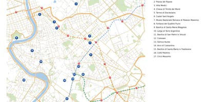
Maps of Rome as a whole, drawn for this site from open data rather than copied from printed sources.
The maps in this section are produced from OpenStreetMap, a map database maintained by volunteers and published under the Open Database Licence. Streets, parks, the river and public transport are drawn from that data, then styled and annotated here.
Each of these maps carries the mention © OpenStreetMap contributors, as the licence requires. Because the data is updated continuously, a map shows the state of Rome on the date of extraction given in its caption.