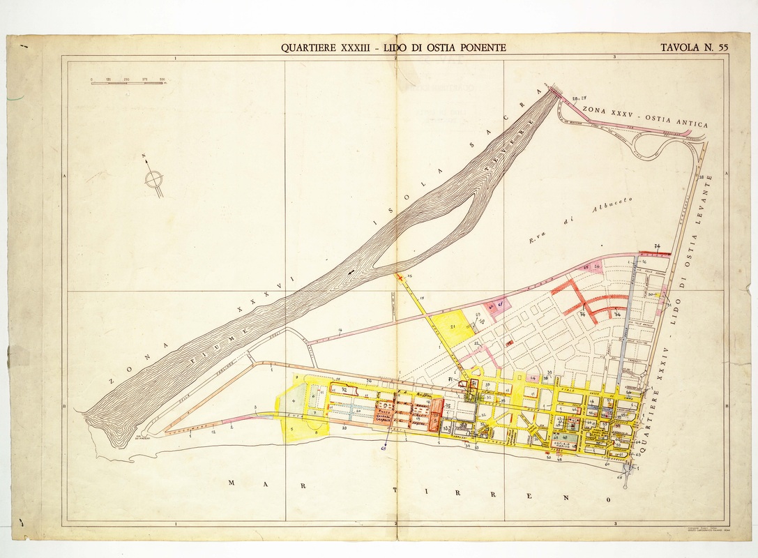
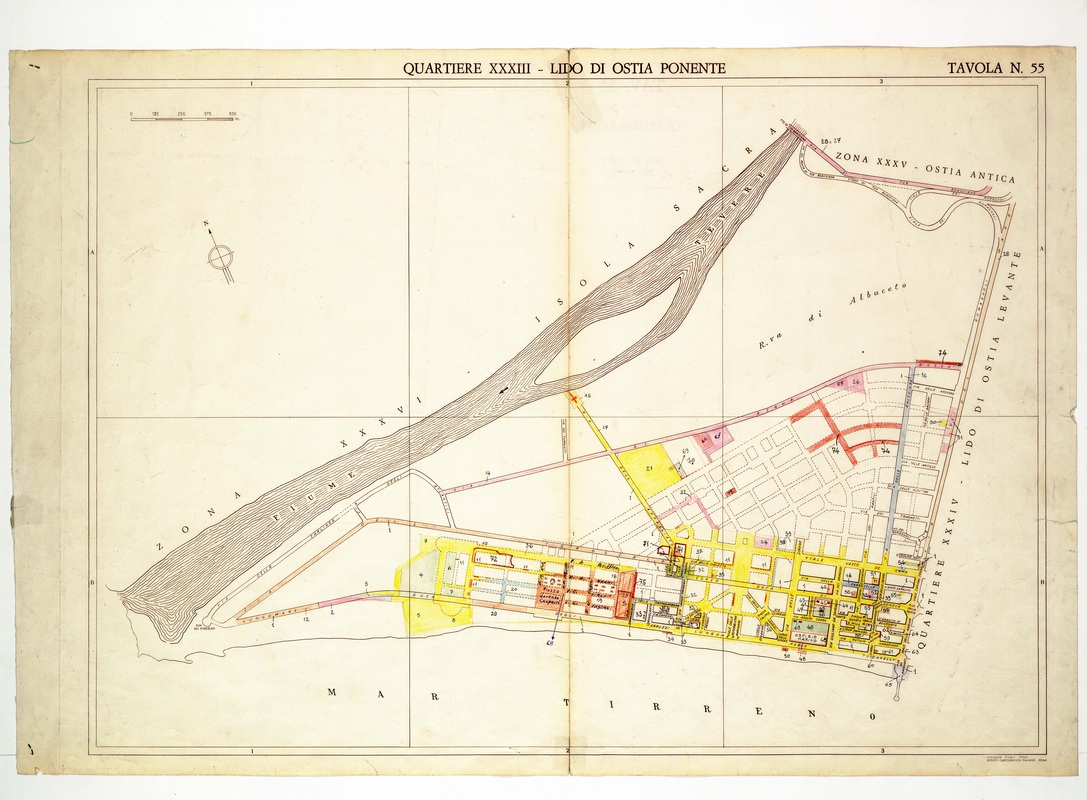
Quartiere XXXIII Lido di Ostia Ponente on Tavola 55, a coastal strip of yellow blocks on the Tyrrhenian Sea beside the Isola Sacra and the Tiber mouth.
Source: Old map, public domain
The long channel of the Tiber slants across the upper left around the Isola Sacra, and the sea occupies the bottom edge. Yellow blocks crowd the seafront at right, an uncoloured grid of planned streets lies behind, and the Ostia Antica zone is named at the top right.