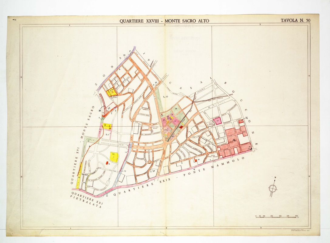
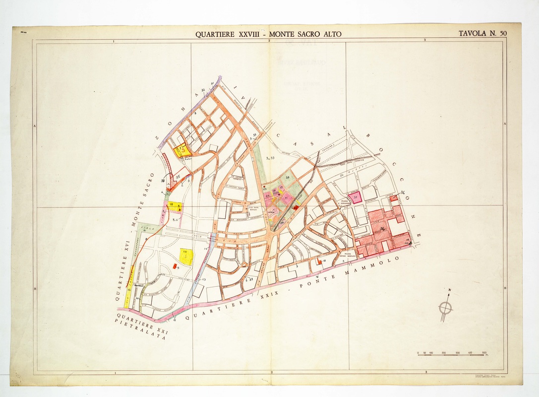
Quartiere XXVIII Monte Sacro Alto on Tavola 50, a web of streets with a rose-red cluster of lots at the right beside Casal Boccone.
Source: Old map, public domain
An orange main road runs from the northern corner through a central junction, with branching curved streets on both sides. A red block numbered 26 stands out at the lower right, and the western edge borders Monte Sacro and Pietralata.