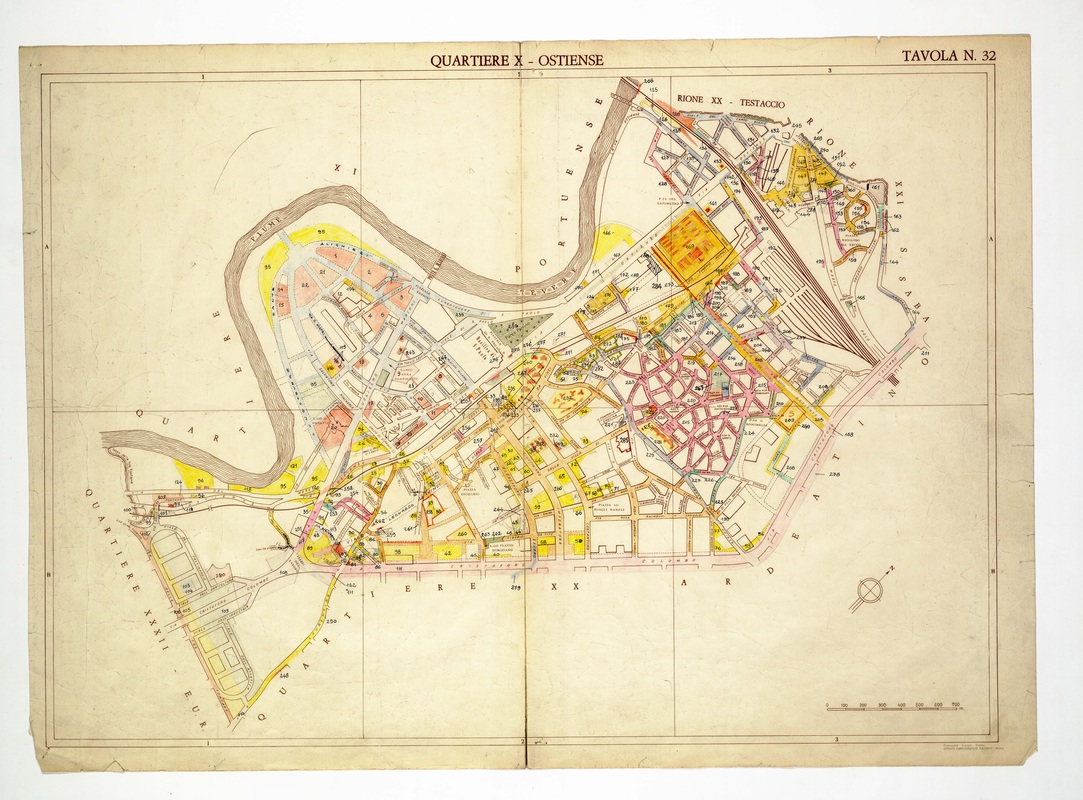
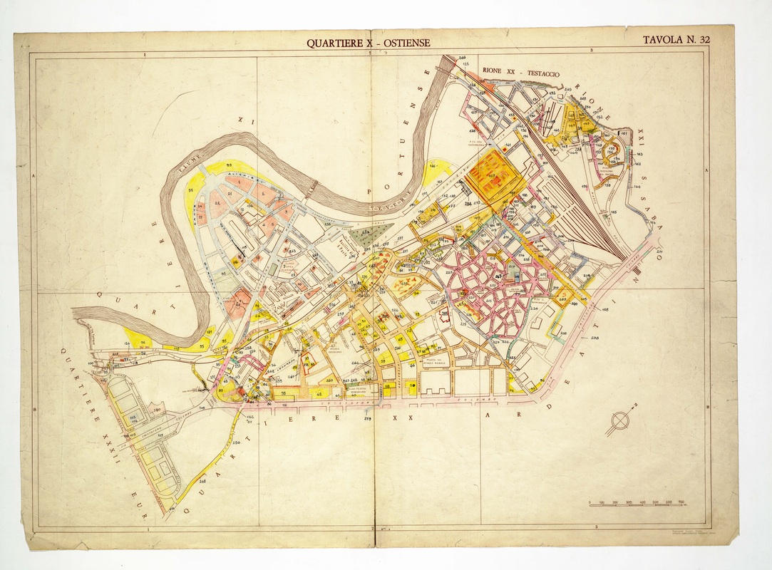
Quartiere X Ostiense on Tavola 32, built around a deep bend of the Tiber, with railway yards and Via Cristoforo Colombo on the southern side.
Source: Old map, public domain
A circular pattern of pink streets, the curving layout of Garbatella, fills the centre right, east of the railway lines. A large orange block stands at the top centre, and the river cuts a loop on the left, beside the sports-ground outlines near the EUR border.