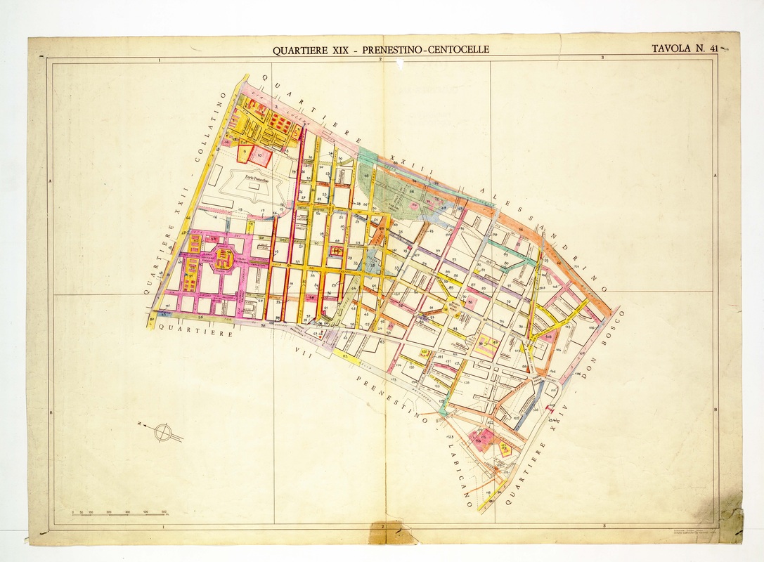
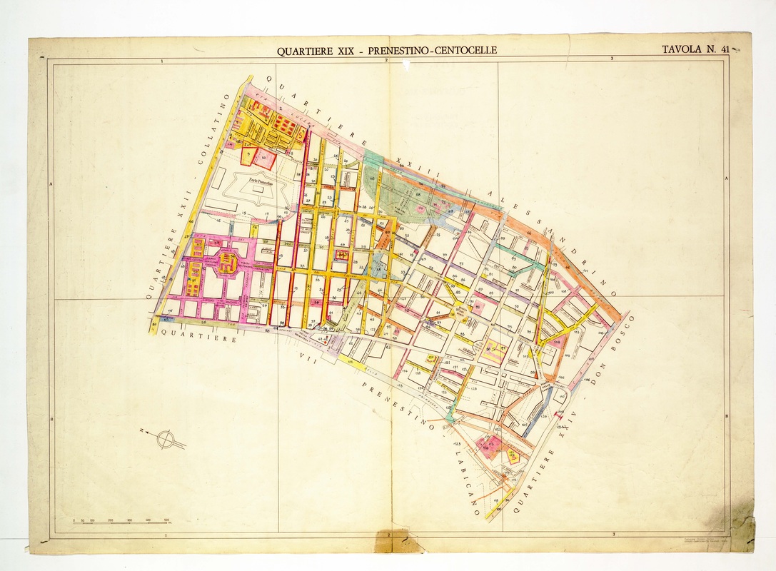
Quartiere XIX Prenestino-Centocelle on Tavola 41, a regular street grid with Forte Prenestino drawn as a star-shaped fort at the upper left.
Source: Old map, public domain
Parallel yellow and orange streets run north to south in the western half, while a green public garden marks the top centre. A pink fan of streets surrounds a round piazza at the left, and a stained, torn corner shows at the lower right.