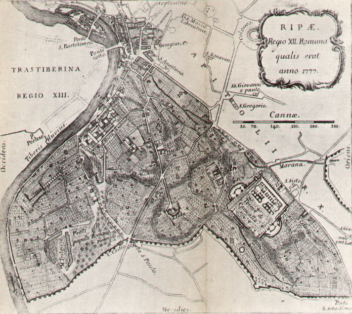
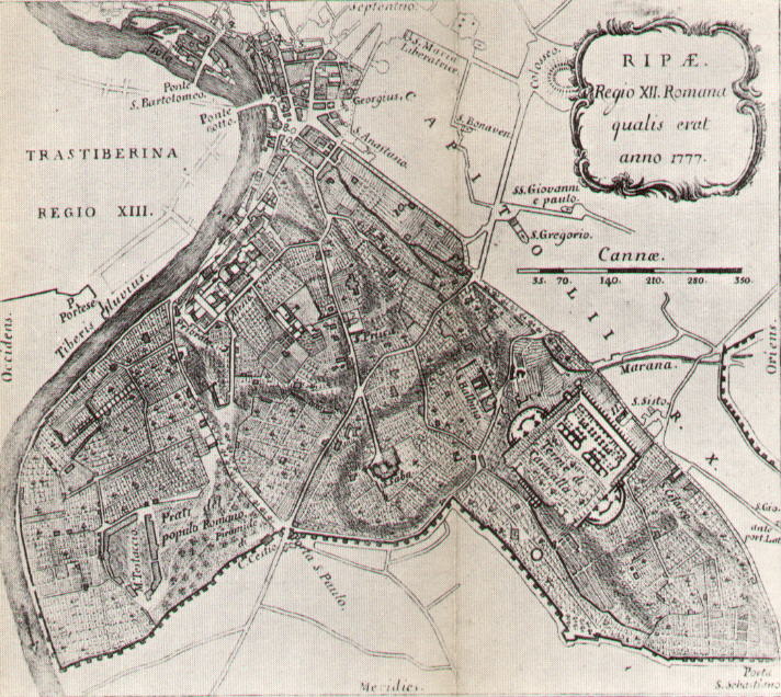
Regio XII Ripa in 1777, covering the Aventine, the Baths of Caracalla and the meadows by Testaccio along the Tiber, down to the walls.
Source: Old map, public domain
Hatched hills and vineyards cover most of the region, from the river crossings at the top down to the wall at the bottom. Labels include Prati del Popolo Romano, Testaccio, the baths of Caracalla and the road to Porta S. Paolo, and a scale in cannae runs along the upper right.