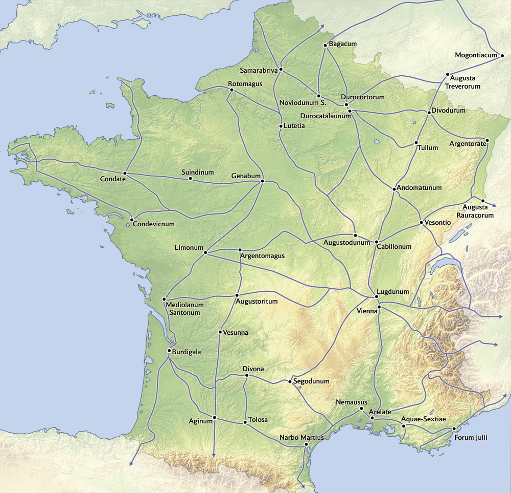
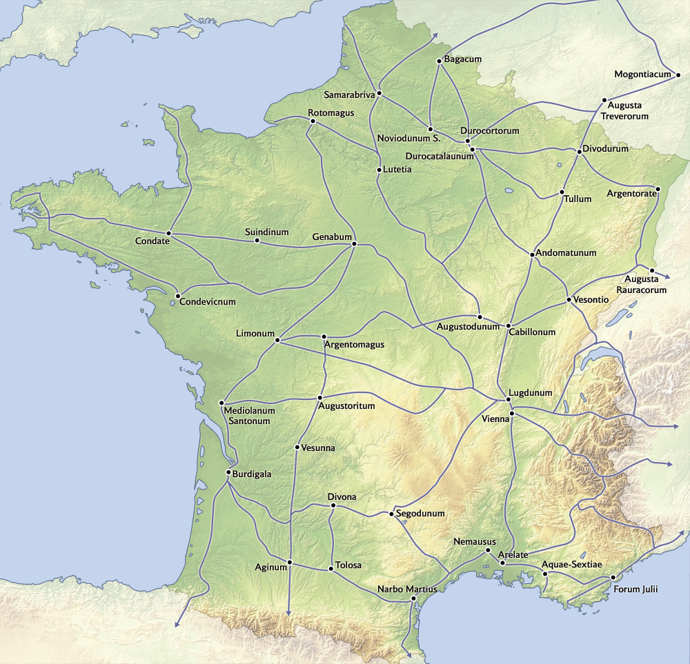
Main routes of Roman Gaul over a relief base, linking Lutetia, Lugdunum and Narbo Martius.
The map sets the roads on a shaded relief background, with towns such as Lutetia, Lugdunum and Narbo Martius named. It shows how the road system followed valleys and passes.