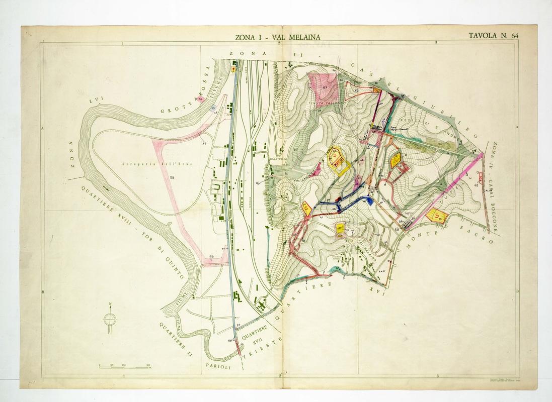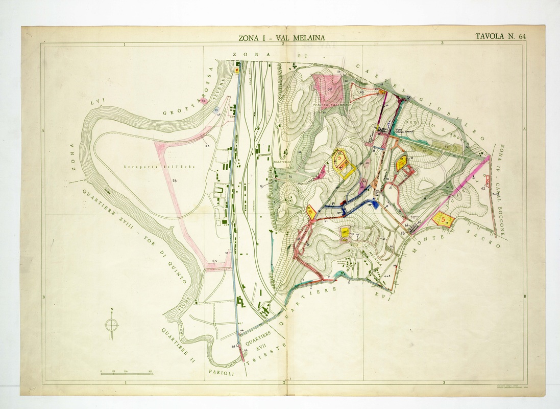
Tavola 64 covers Val Melaina and the Aeroporto dell'Urbe, with the Tiber meander on the left and Monte Sacro along the lower-right edge.
Source: Old map, public domain
Colour is concentrated in the hatched hills on the right, where numbered plots are filled in yellow, red, blue and pink. The railway and the airport sit on the flat ground beside the river, and Castel Giubileo and Casal Boccone are named on the borders.