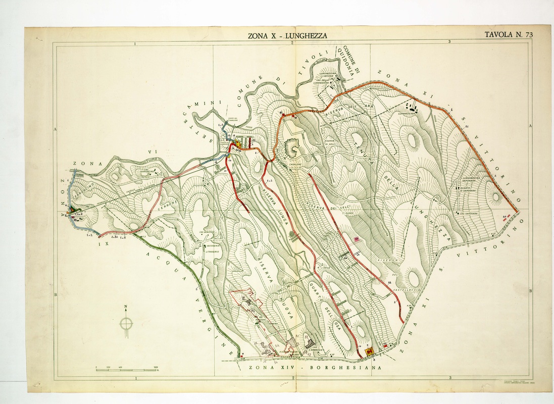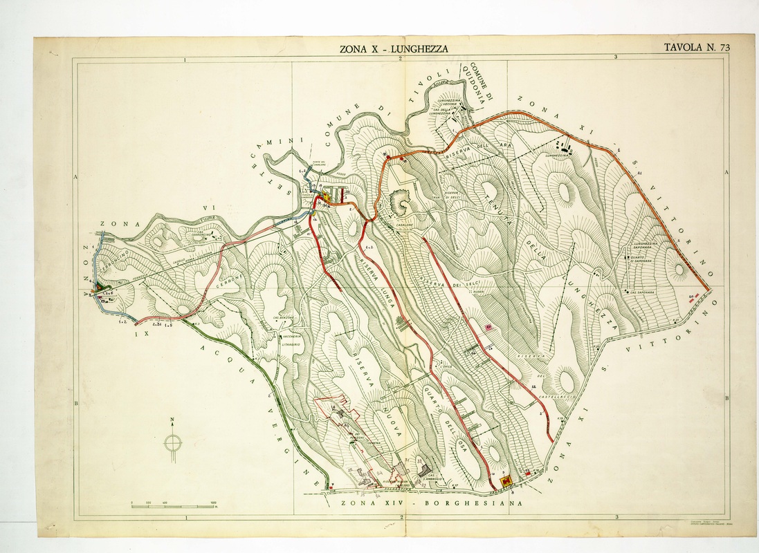
Lunghezza spreads over Riserva Lunga, Riserva Nuova and Riserva dei Selci, with red roads running between the Aniene in the north and Borghesiana to the south.
Source: Old map, public domain
Long parallel ridges separate those reserves, and the Tenuta della Lunghezza fills the eastern half up to San Vittorino. Farm names such as Lunghezzina Saponara appear on the right, and the village stands near the Aniene at the top.