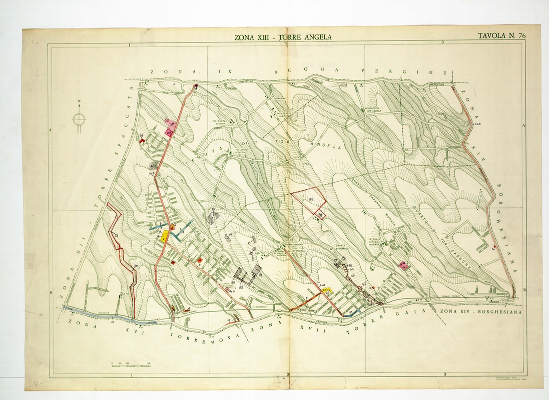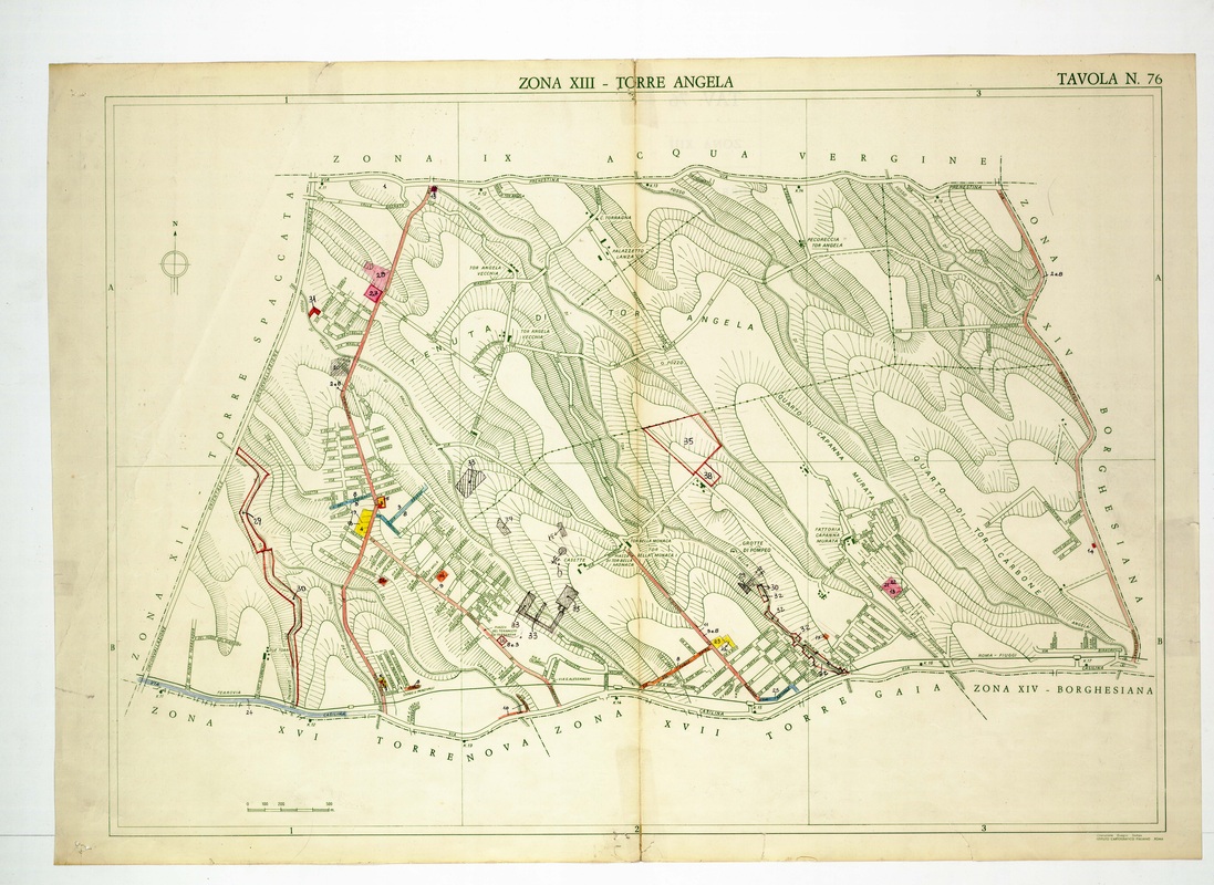
The Torre Angela sheet follows Tenuta di Tor Angela and Quarto di Capanna Murata across diagonal ridges toward the Via Casilina along the base.
Source: Old map, public domain
A red road drops from the Via Prenestina in the north to the built-up belt in the south-west, where blue and yellow blocks are coloured by hand. Grotte di Pompeo and Tor Bella Monaca appear near the lower middle.