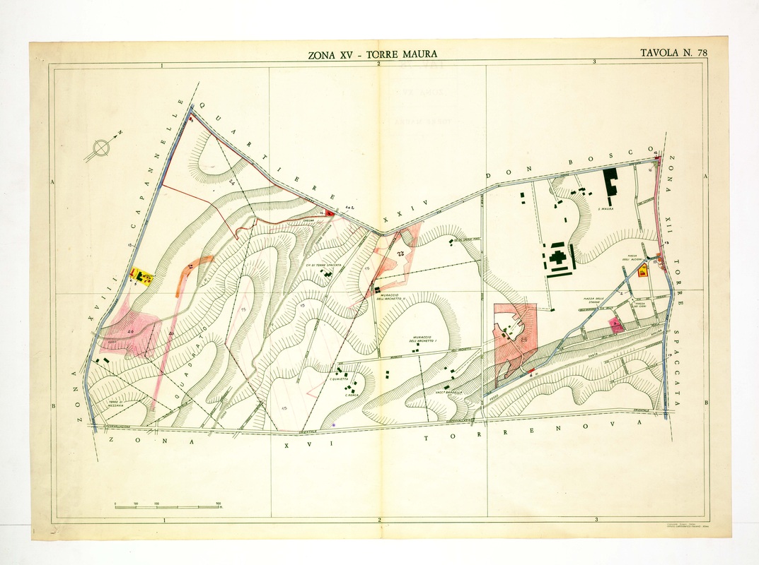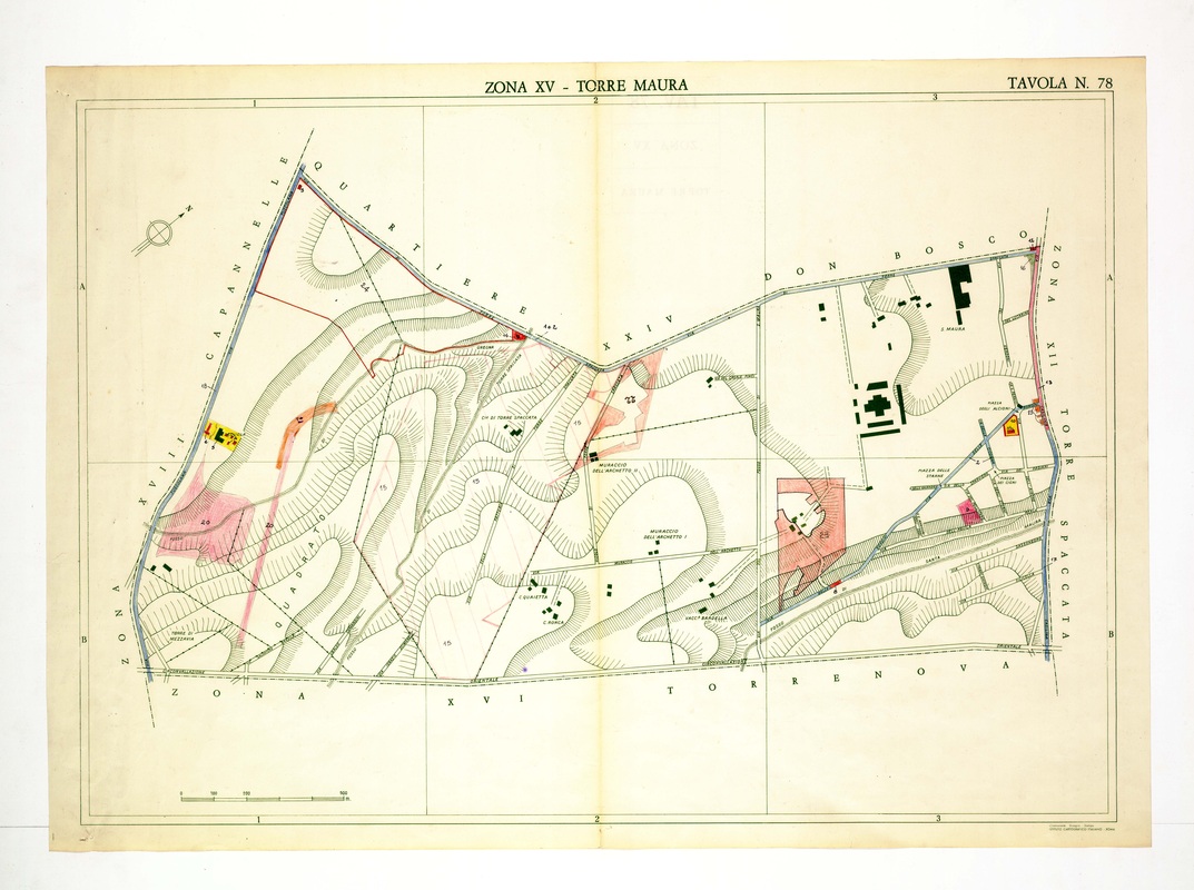
Torre Maura includes the large institutional complex of S. Maura in the north-east and the Muraccio dell'Archetto farms along a track in the centre.
Source: Old map, public domain
Quartiere Don Bosco forms the upper boundary, with Capannelle to the left and Torre Spaccata to the right. Pink areas mark numbered plots, and the Circonvallazione Orientale runs along the bottom toward Torrenova.