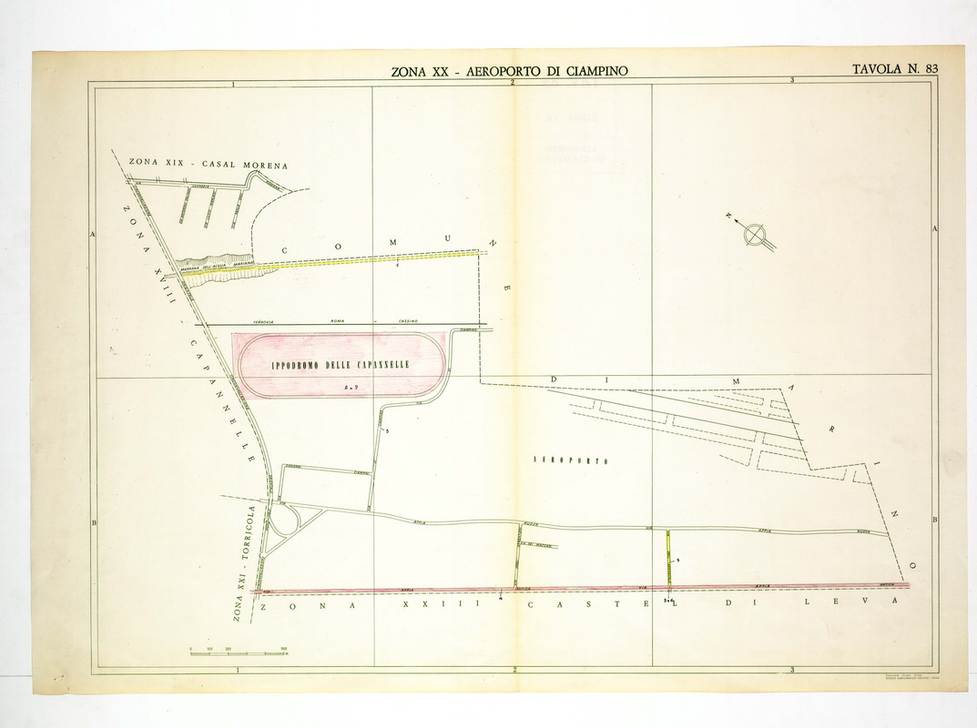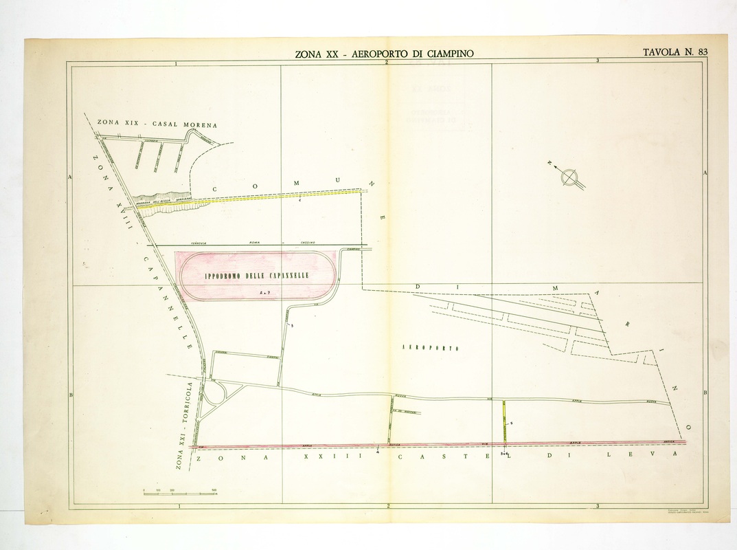
Aeroporto di Ciampino is mostly empty ground here, with the Ippodromo delle Capannelle outlined in pink and the Via Appia Antica in red along the base.
Source: Old map, public domain
Thin lines trace the Rome-Cassino railway, the Via Appia Nuova and a few access roads, while dashed runway strips appear in the east inside the commune of Marino. Almost no relief hatching is drawn.