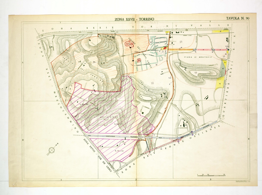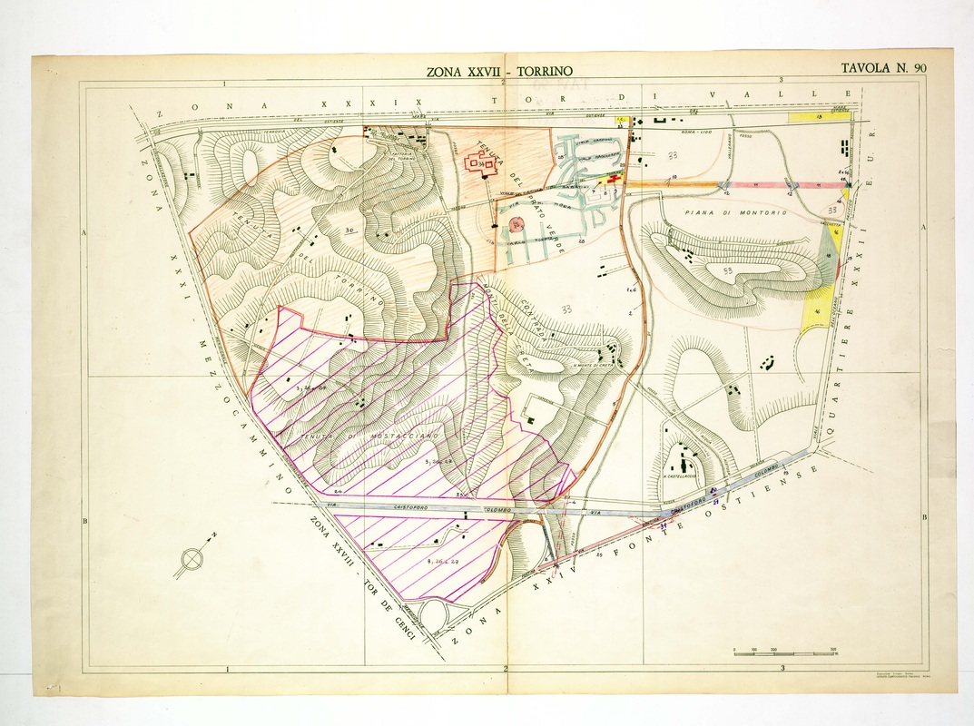
Torrino is split by the Via Cristoforo Colombo, with Tenuta del Torrino and Tenuta di Mostacciano on the west and Piana di Montorio on the east.
Source: Old map, public domain
Magenta hatching fills the Mostacciano area and an orange outline encloses the upper parcels, while a small street plan sits beside the Via Ostiense at the top. The Roma-Lido railway runs along the north edge.