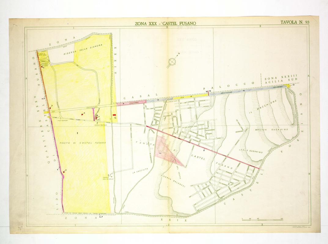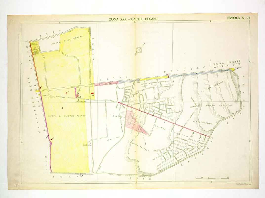
Castel Fusano combines the yellow-washed Pineta and Riserva della Signora with the street grid of the Tenuta on the right, crossed by a red road.
Source: Old map, public domain
The Via Cristoforo Colombo runs across the top, with pink and grey colouring along parts of its length. Riserva Baldacci, La Cacciuta, Il Macchione and Macchia Guerrino are named in the hills of the south-east.