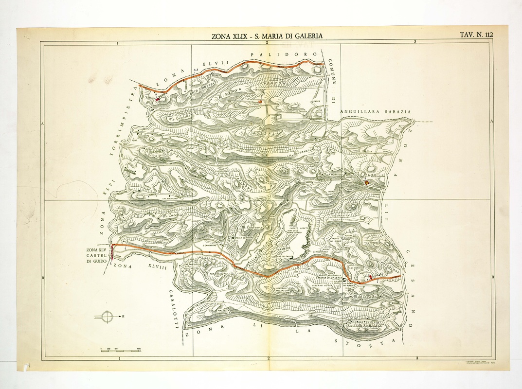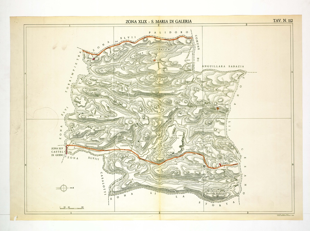
Santa Maria di Galeria is drawn as an almost continuous tangle of hills, with M. Cacchio, M. Centrone and the Riserva Pontoni among the names visible.
Crossing the sheet from west to east is an orange road, passing the village, and Palidoro, Anguillara Sabazia and Cesano appear beyond the borders. Monte Loreto and La Fontanella are labelled near the centre-right.