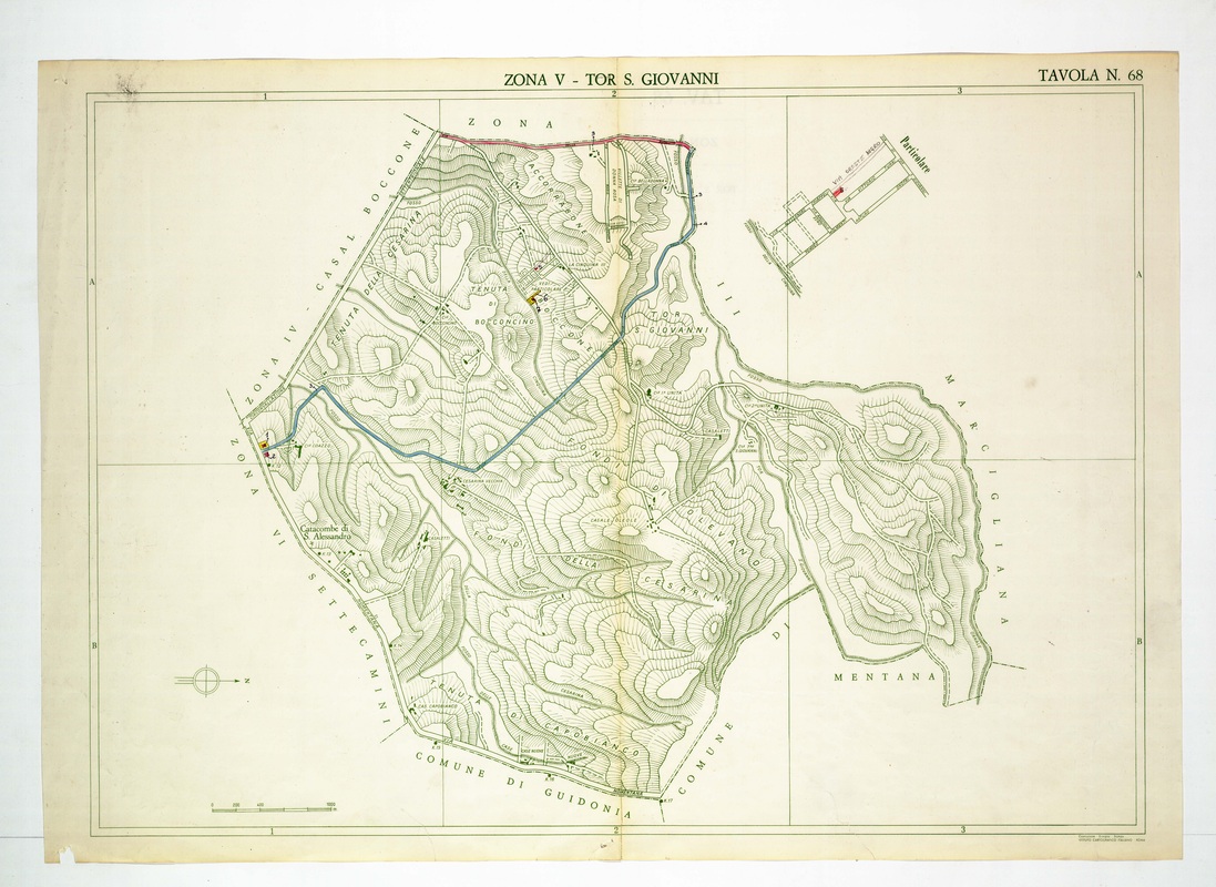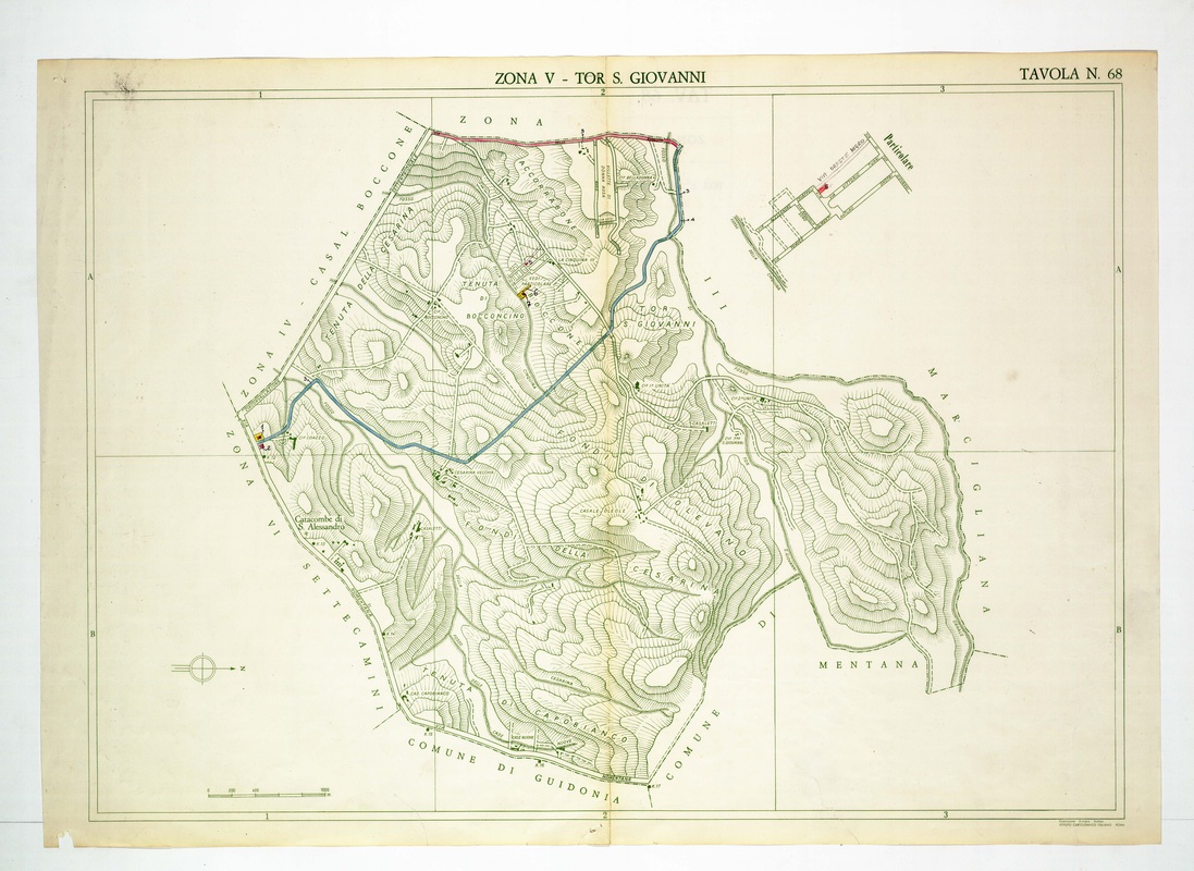
Tor S. Giovanni stretches over Tenuta della Cesarina and Capobianco, with the Catacombe di S. Alessandro near the west corner and a Particolare inset at top right.
Source: Old map, public domain
A blue line cuts diagonally across the hills and a short red stretch runs along the northern limit. The inset enlarges a small street plan, and the sheet is bordered by Guidonia, Mentana and Marcigliana.