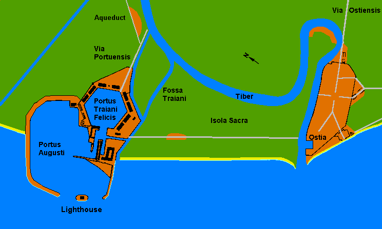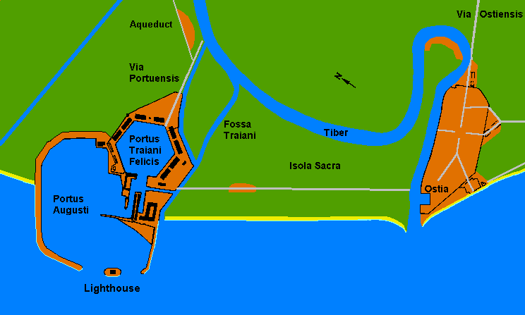
This colour diagram shows Portus Augusti, Portus Traiani Felicis, the Fossa Traiani, the Via Portuensis and Ostia on the Via Ostiensis around Isola Sacra.
Orange marks built land, green marks open ground and blue marks water, with a lighthouse at the foot of the harbour. A line labelled Aqueduct appears at the top, and a yellow beach strip follows the coast.