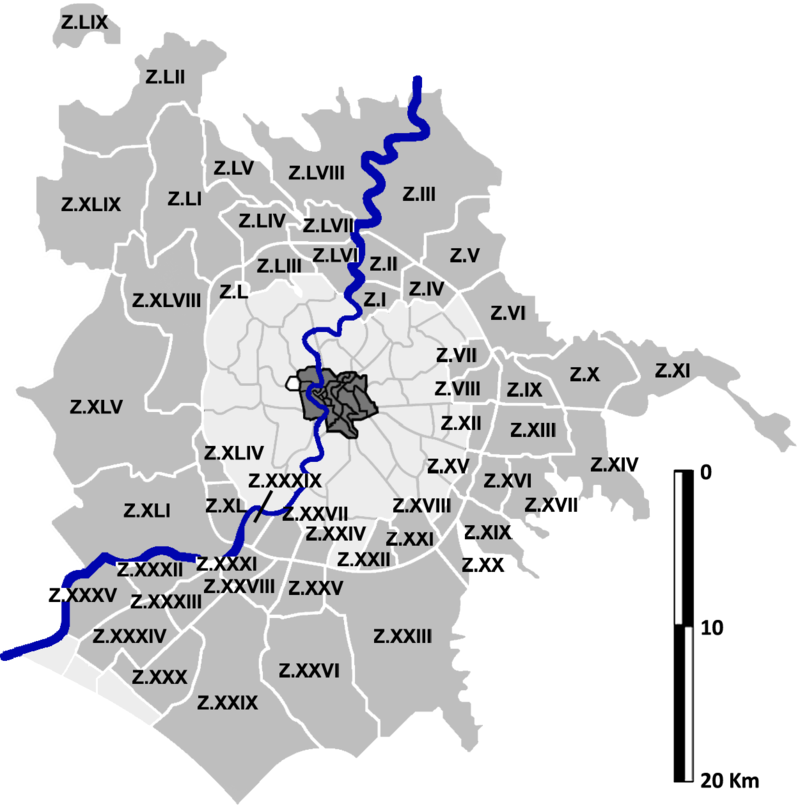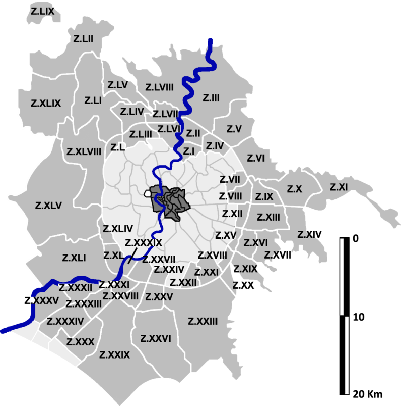
Key diagram of the 59 Agro Romano zones, numbered Z.I to Z.LIX in Roman numerals, set in grey around the city with the Tiber drawn in blue.
Grey outlines separate each zone, a darker cluster in the middle stands for the inner city, and a paler ring surrounds it. The Tiber snakes through in blue, and a vertical bar scale at the right edge gives the distances.